


Heritage Quest
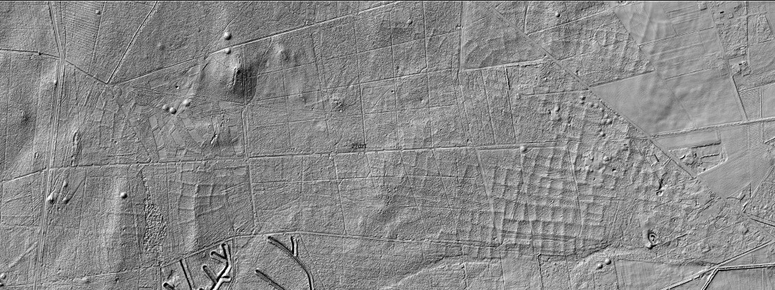
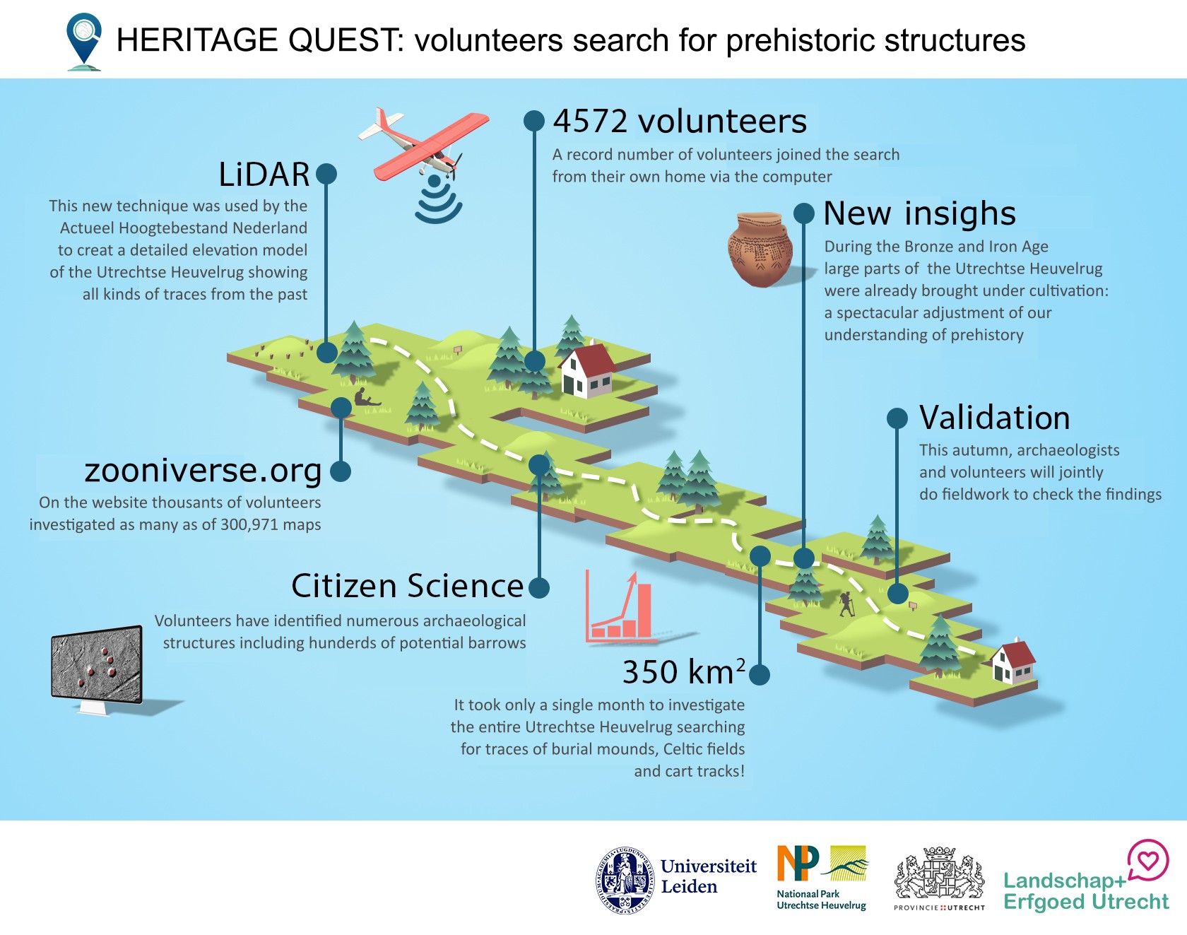
The aim of this project is to find archaeological remains hidden under dense vegetation cover, especially prehistoric burial mounds and field systems. In recent years high-resolution elevation maps created with a technique called LiDAR have become widely available. The big advantage compared to many other measurement techniques is that LiDAR is not hampered by the presence of vegetation. This allows the investigation of areas in which archaeological remains are currently obscured by forest cover or other types of vegetation.
In this project we investigate the Utrechtse Heuvelrug, a heavily forested region in the Netherlands. Over the course of 2019, Heritage Quest has investigated the Veluwe with spectacular results (see section on results). The Veluwe and the Utrechtse Heuvelrug are similar in many respects. Archaeologically, both regions are famous for the large number of burial mounds. However, the dense forest cover undoubtedly hides many more.
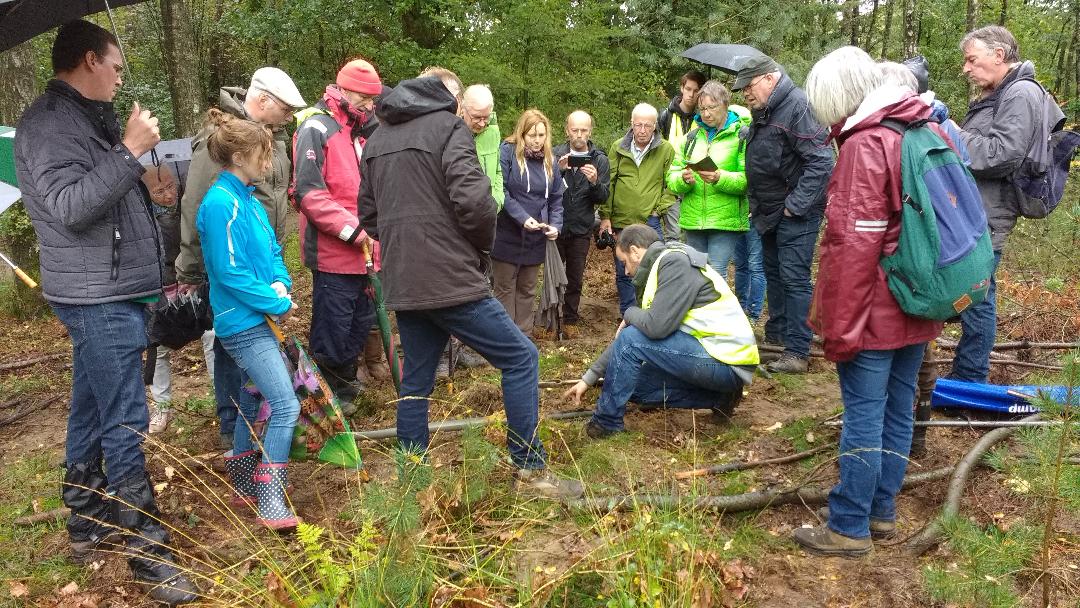
By jointly inspecting the c. 400 km2 of the Utrechtse Heuvelrug we are certain that many unknown archaeological remains will be discovered. These new discoveries will inform us about the past societies that left them and they will be added to the national database of known archaeological features and as such protected for posterity.